Back Parcu Naziunale Ruaha CO Ruaha nationalpark Danish Ruaha-Nationalpark German Nacia Parko Ruaha EO Parque nacional Ruaha Spanish Ruahan kansallispuisto Finnish Parc national de Ruaha French Parco nazionale del Ruaha Italian ルアハ国立公園 Japanese റുവാഹ ദേശീയോദ്യാനം Malayalam
| Ruaha National Park | |
|---|---|
 | |
| Location | Tanzania |
| Nearest city | Iringa |
| Coordinates | 7°30′S 35°00′E / 7.500°S 35.000°E |
| Area | 20,226 km2 (7,809 sq mi) |
| Established | 1964 |
| Visitors | 21,267 (in 2012[1]) |
| Governing body | Tanzania National Parks Authority |
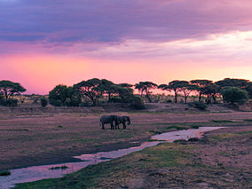
Ruaha National Park is a national park in Tanzania. In 2008, the Usangu Game Reserve and other important wetlands were added to the park, increasing its size to about 20,226 km2 (7,809 sq mi).
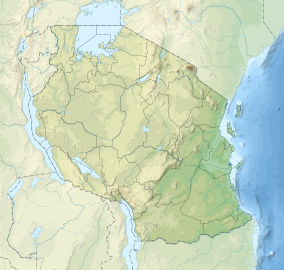
The park is about 130 kilometres (81 mi) west of Iringa. The park is a part of the 45,000 square kilometres (17,000 sq mi) Rungwa-Kizigo-Muhesi ecosystem,[2] which includes the Rungwa Game Reserve, the Kizigo and Muhesi Game Reserves, and the Mbomipa Wildlife Management Area.[3]
The park's name is derived from the Great Ruaha River, which flows along its southeastern margin and is the focus of game-viewing. The park can be reached by car on a dirt road from Iringa, and there are two Airstrips – Msembe Airstrip at Msembe (park headquarters) and Jongomeru Airstrip, near the Jongomeru Ranger Post.[2]
- ^ "Tanzania National parks Corporate Information". Tanzania Parks. TANAPA. Archived from the original on 17 September 2008. Retrieved 22 December 2015.
- ^ a b "Ruaha National Park". Tanzania National Parks. 2012. Archived from the original on 2012-09-29. Retrieved 23 November 2014.
- ^ Mbomipa Wildlife Management Area. Twma.co.tz. Retrieved on 14 September 2016.
