Back Saint-Liboire CEB Saint-Liboire Spanish Saint-Liboire (Quebec) EU سن-لیبوآر، کبک FA Saint-Liboire French Saint-Liboire Italian Saint-Liboire (Quebec) Portuguese Saint-Liboire Swedish سینٹ-لبویرے، کیوبک UR
Saint-Liboire | |
|---|---|
 | |
 Location within Les Maskoutains RCM | |
| Coordinates: 45°39′N 72°46′W / 45.650°N 72.767°W[1] | |
| Country | Canada |
| Province | Quebec |
| Region | Montérégie |
| RCM | Les Maskoutains |
| Settled | 1710 |
| Constituted | August 17, 1994 |
| Government | |
| • Mayor | Denis Chabot |
| • Federal riding | Saint-Hyacinthe—Bagot |
| • Prov. riding | Saint-Hyacinthe |
| Area | |
• Total | 75.20 km2 (29.03 sq mi) |
| • Land | 72.74 km2 (28.09 sq mi) |
| Population (2011)[4] | |
• Total | 3,051 |
| • Density | 41.9/km2 (109/sq mi) |
| • Pop 2006-2011 | |
| • Dwellings | 1,107 |
| Time zone | UTC−05:00 (EST) |
| • Summer (DST) | UTC−04:00 (EDT) |
| Postal code(s) | |
| Area code(s) | 450 and 579 |
| Highways | |
| Geocode | 54072 |
| People | Liboirois, Liboiroise |
| Website | www.municipalite. st-liboire.qc.ca |
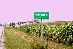
Saint-Liboire (French pronunciation: [sɛ̃ libwaʁ]; formerly Saint-Liboire-de-Bagot) is a municipality in the municipalité régionale de comté des Maskoutains in Québec, Canada, located in the administrative region of Montérégie. The population as of the 2011 Canadian Census was 3,051.
- ^ Cite error: The named reference
toponymiewas invoked but never defined (see the help page). - ^ a b "Ministère des Affaires municipales, des Régions et de l'Occupation du territoire: Saint-Liboire". Archived from the original on 2015-12-12. Retrieved 2012-03-11.
- ^ Parliament of Canada Federal Riding History: SAINT-HYACINTHE--BAGOT (Quebec)
- ^ a b Cite error: The named reference
cp2011was invoked but never defined (see the help page).
