Back Siachen Īsflōd ANG نهر سياشين الجليدي Arabic सियाचिन ग्लेशियर BH সিয়াচেন হিমবাহ Bengali/Bangla Siachen Catalan Siachen Glacier CEB Siačen Czech Siachengletscher German Siaĉen EO Glaciar de Siachen Spanish
| Siachen Glacier | |
|---|---|
 Satellite imagery of the Siachen Glacier | |
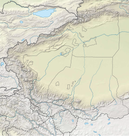
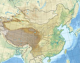
Location of the Siachen Glacier within the greater Karakoram region | |
| Type | Mountain glacier |
| Location | Karakoram, Ladakh (controlled by India, claimed by Pakistan) |
| Coordinates | 35°11′55.00″N 77°12′5.00″E / 35.1986111°N 77.2013889°E |
| Area | 2,500 km2 (970 sq mi)[1] |
| Length | 76 km (47 mi) using the longest route as is done when determining river lengths or 70 km (43 mi) if measuring from Indira Col[2] |
 | |
The Siachen Glacier is a glacier located in the eastern Karakoram range in the Himalayas at about 35°25′16″N 77°06′34″E / 35.421226°N 77.109540°E, just northeast of the point NJ9842 where the Line of Control between India and Pakistan ends.[3][4] At 76 km (47 mi) long, it is the longest glacier in the Karakoram and second-longest in the world's non-polar areas.[5] It falls from an altitude of 5,753 m (18,875 ft) above sea level at its head at Indira Col on the India–China border down to 3,620 m (11,875 ft) at its terminus. The entire Siachen Glacier, with all major passes, has been under the administration of India as part of the union territory of Ladakh, located in the Kashmir region since 1984.[6][7][8][9] Pakistan maintains a territorial claim over the Siachen Glacier[10] and controls the region west of Saltoro Ridge, lying west of the glacier,[11] with Pakistani posts located 1 km below more than 100 Indian posts on the ridge.[12][13]
The Siachen Glacier lies immediately south of the great drainage divide that separates the Eurasian Plate from the Indian subcontinent in the extensively glaciated portion of the Karakoram sometimes called the "Third Pole". The glacier lies between the Saltoro Ridge immediately to the west and the main Karakoram range to the east. The Saltoro Ridge originates in the north from the Sia Kangri peak on the China border in the Karakoram range. The crest of the Saltoro Ridge's altitudes range from 5,450 to 7,720 m (17,880 to 25,330 feet). The major passes on this ridge are, from north to south, Sia La at 5,589 m (18,336 ft), Bilafond La at 5,450 m (17,880 ft), and Gyong La at 5,689 m (18,665 ft). The average winter snowfall is more than 1000 cm (35 ft) and temperatures can dip to −50 °C (−58 °F). Including all tributary glaciers, the Siachen Glacier system covers about 700 km2 (270 sq mi).
- ^ Desmond/Kashmir, Edward W. (31 July 1989). "The Himalayas War at the Top of the World". Time. Archived from the original on 14 January 2009. Retrieved 11 October 2008.
- ^ Dinesh Kumar (13 April 2014). "30 Years of the World's Coldest War". The Tribune. Chandigarh, India. Retrieved 18 April 2014.
- ^ Cite error: The named reference
Lyonwas invoked but never defined (see the help page). - ^ "The Tribune, Chandigarh, India – Opinions". The Tribune.
- ^ Siachen Glacier is 76 km (47 mi) long; Tajikistan's Fedchenko Glacier is 77 km (48 mi) long. The second longest in the Karakoram Mountains is the Biafo Glacier at 63 km (39 mi). Measurements are from recent imagery, supplemented with Russian 1:200,000 scale topographic mapping as well as the 1990 "Orographic Sketch Map: Karakoram: Sheet 2", Swiss Foundation for Alpine Research, Zurich.
- ^ Gauhar, Feryal Ali; Yusuf, Ahmed (2 November 2014). "Siachen: The place of wild roses". Retrieved 4 August 2017.
- ^ North, Andrew (12 April 2014). "Siachen dispute: India and Pakistan's glacial fight". BBC. Retrieved 4 August 2017.
- ^ "India gained control over Siachen in 1984". The Times of India. 9 April 2012. Retrieved 4 August 2017.
- ^ "Blog: The Siachen Story, Then And Now". NDTV.com.
- ^ Siddiqui, Naveed (4 August 2020). "In landmark move, PM Imran unveils 'new political map' of Pakistan". Dawn. Retrieved 5 August 2020.
- ^ Gokhale, Nitin A (2015). Beyond NJ 9842: The SIACHEN Saga. Bloomsbury Publishing. p. 364. ISBN 9789384052263.
- ^ Service, Tribune News. "Life & death in world's highest combat zone". Tribuneindia News Service.
- ^ "Siachen deaths harden resolve to hold glacier: Army chief". Hindustan Times. 18 February 2016.


