Back Parc Nacional de la Sila Catalan Národní park Sila Czech Nationalpark Sila Danish Nationalpark Sila German Sila Nacia Parko EO Parque nacional de la Sila Spanish Parc national de la Sila French Sila Nemzeti Park Hungarian Parco nazionale della Sila Italian სილის ეროვნული პარკი KA
| Parco Nazionale della Sila | |
|---|---|
 Lago di Ariamacina, Sila National Park | |
| Location | Calabria |
| Nearest city | Crotone |
| Coordinates | 39°22′34″N 16°35′31″E / 39.37611°N 16.59194°E |
| Area | 736.95 km2 (284.54 sq mi) |
| Established | 1997 |
| Governing body | Ministero dell'Ambiente |
| www | |
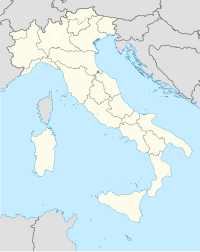
Sila National Park (Italian: Parco Nazionale della Sila) is an Italian national park in Calabria. It was established in 1997 and covers about 74,000 hectares. Its highest mountains are Mt. Botte Donato (1,928m), in Sila Grande, and Mt. Gariglione (1,764m) in Sila Piccola. The park is set with the Regional Decree 14.11.2002 from the Official Journal num. 63 - 17/03/2003 and includes its own Management Agency. This park area includes the territories formerly as part of the “Historical” Calabria National Park (1968), which protects areas of great environmental interest in Sila Piccola, Sila Grande and Sila Greca, for a total of 736.95 square kilometers, in 21 municipalities, 6 Mountains Communities (Comunità Montane) and 3 provinces of Calabria Region.[1][2][3][4][5][6]
- ^ "Sila – Welcome to Santa Monica Resort & Village".
- ^ "The Sila: A National Park in Calabria not to miss!". 29 November 2015.
- ^ "Special offers, last minute, discounts and promotions Sila National Park".
- ^ "Sila National Park - Mi Terruño". Archived from the original on 2016-03-08. Retrieved 2016-03-05.
- ^ "The Sila and its extraordinary beauty". 17 November 2014.
- ^ "Sila – Visit Calabria".
