Back جبل سپرينجير ARZ Springer Mountain (bukid sa Tinipong Bansa, Georgia) CEB Springer Mountain German Springer Mountain French Mons Springer LA Springer Mountain NB Springer Mountain Romanian Спрингер (гора) Russian سپرنگیر ماؤنٹین UR
| Springer Mountain | |
|---|---|
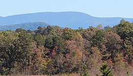
 Springer Mountain viewed from East Ellijay | |
| Highest point | |
| Elevation | 3,770 feet (1,149 m)[1] |
| Prominence | 1,142 ft (348 m)[2] |
| Coordinates | 34°37′36″N 84°11′37″W / 34.6266410°N 84.1935399°W[1] |
| Geography | |
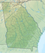
| Location | |
| Parent range | Blue Ridge Mountains |
| Topo map | USGS Noontootla |
| Climbing | |
| First ascent | unknown |
| Easiest route | Appalachian Trail |
Springer Mountain is a mountain located in the Chattahoochee National Forest on the border of Fannin and Gilmer counties. Located in the Blue Ridge Mountains in northern Georgia, the mountain has an elevation of about 3,770 feet (1,149 m).[1] Springer Mountain serves as the southern terminus for the Appalachian and Benton MacKaye trails.
- ^ a b c "Springer Mountain". Geographic Names Information System. United States Geological Survey, United States Department of the Interior. Retrieved 2024-05-17.
- ^ "Springer Mountain, Georgia". Peakbagger.com.
