Back Stowe, Vermont AF ستو (فيرمونت) Arabic ایستوو، ورمونت AZB Stowe (Vermont) Catalan Стоу (Вермонт) CE Stowe (lungsod sa Tinipong Bansa, Vermont) CEB Stowe (Vermont) Czech Stowe, Vermont CY Stowe (Vermont) German Stowe (Vermont) Spanish
Stowe, Vermont | |
|---|---|
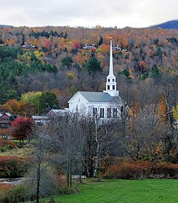
 Stowe Community Church | |
| Nickname: The Ski Capital of the East | |
 Stowe, Vermont | |
| Coordinates: 44°28′31″N 72°42′8″W / 44.47528°N 72.70222°W | |
| Country | United States |
| State | Vermont |
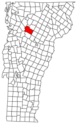
| County | Lamoille |
| Communities | Stowe Lower Village Moscow Stowe Fork West Branch |
| Government | |
| • Type | Select board |
| Area | |
• Total | 72.76 sq mi (188.45 km2) |
| • Land | 72.60 sq mi (188.03 km2) |
| • Water | 0.16 sq mi (0.42 km2) |
| Elevation | 889 ft (271 m) |
| Population (2020) | |
• Total | 5,223 |
| • Density | 72/sq mi (27.8/km2) |
| Time zone | UTC-5 (Eastern (EST)) |
| • Summer (DST) | UTC-4 (EDT) |
| ZIP code | 05672 |
| Area code | 802 |
| FIPS code | 50-70525[3] |
| Website | www |
Stowe is a town in Lamoille County, Vermont, United States. The population was 5,223 at the 2020 census.[4] The town lies on Vermont Routes 108 and 100. It is nicknamed "The Ski Capital of the East" and is home to Stowe Mountain Resort, a ski facility with terrain on Mount Mansfield, the highest peak in Vermont, and Spruce Peak.

- ^ "2019 U.S. Gazetteer Files". United States Census Bureau. Retrieved February 10, 2021.
- ^ a b U.S. Geological Survey Geographic Names Information System: Stowe, Vermont
- ^ "U.S. Census website". United States Census Bureau. Retrieved January 31, 2008.
- ^ "Census - Geography Profile: Stowe town, Lamoille County, Vermont". United States Census Bureau. Retrieved January 6, 2022.

