Back Swartberge AF سوارتبيرج ARZ Swartberg Catalan Swartbergbjergene Danish Swartberge German Swartberg Spanish Swartberg EU Swartbergin vuoristo Finnish Swartberg French Swartberg Italian
| Swartberg | |
|---|---|
 Swartberg pass | |
| Highest point | |
| Peak | Seweweekspoortpiek |
| Elevation | 2,325 m (7,628 ft) |
| Listing | List of mountain ranges of South Africa |
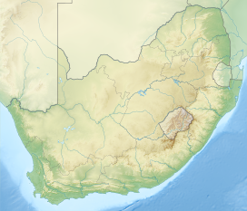
| Coordinates | 33°22′0″S 22°21′15″E / 33.36667°S 22.35417°E |
| Dimensions | |
| Length | 230 km (140 mi) ESE/WNW |
| Width | 70 km (43 mi) NNE/SSW |
| Geography | |
| Country | South Africa |
| Province | Western Cape |
| Geology | |
| Orogeny | Cape Fold Belt |
| Rock age(s) | Carboniferous and Permian |
| Rock type | Quartzitic sandstone |
| Part of | Cape Floral Region Protected Areas |
| Criteria | Natural: (ix), (x) |
| Reference | 1007bis |
| Inscription | 2004 (28th Session) |
| Extensions | 2015 |
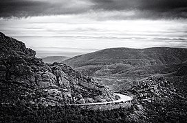
The Swartberg mountains (black mountain in English) are a mountain range in the Western Cape province of South Africa. It is composed of two main mountain chains running roughly east–west along the northern edge of the semi-arid Little Karoo. To the north of the range lies the other large semi-arid area in South Africa, the Great Karoo. Most of the Swartberg Mountains are above 2000 m high, making them the tallest mountains in the Western Cape. It is also one of the longest, spanning some 230 km from south of Laingsburg in the west to between Willowmore and Uniondale in the east. Geologically, these mountains are part of the Cape Fold Belt.
Much of the Swartberg is part of a UNESCO World Heritage Site.[citation needed]
