Back مقاطعة سويتواتر (وايومنغ) Arabic Svitvoter (Vayominq) AZ Sweetwater County, Wyoming BAR Суитуотър (окръг) Bulgarian সুইটৱাটার কাউন্টি, ৱাইওমিং BPY Sweetwater Gông (Wyoming) CDO Суитуотер (гуо, Вайоминг) CE Sweetwater County CEB Sweetwater County, Wyoming CY Sweetwater County German
Sweetwater County | |
|---|---|
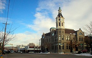
 Rock Springs City Hall, 2007 | |
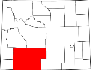
 Location within the U.S. state of Wyoming | |
 Wyoming's location within the U.S. | |
| Coordinates: 41°40′N 108°53′W / 41.66°N 108.89°W | |
| Country | |
| State | |
| Founded | December 17, 1867 |
| Named for | Sweetwater River |
| Seat | Green River |
| Largest city | Rock Springs |
| Area | |
• Total | 10,491 sq mi (27,170 km2) |
| • Land | 10,427 sq mi (27,010 km2) |
| • Water | 64 sq mi (170 km2) 0.6% |
| Population (2020) | |
• Total | 42,272 |
• Estimate (2023)[1] | 41,249 |
| • Density | 4.0/sq mi (1.6/km2) |
| Time zone | UTC−7 (Mountain) |
| • Summer (DST) | UTC−6 (MDT) |
| Area code | 307 |
| Congressional district | At-large |
| Website | www |
Sweetwater County is a county in southwestern Wyoming, United States.[2] As of the 2020 United States Census, the population was 42,272, making it the fourth-most populous county in Wyoming.[3] Its county seat is Green River.[4] By area, it is the largest county in Wyoming. Its southern boundary line abuts the north lines of the states of Colorado and Utah.
Sweetwater County comprises the Rock Springs, Green River, Wyoming Micropolitan Statistical Area.
- ^ "Annual Estimates of the Resident Population for Counties: April 1, 2020 to July 1, 2023". United States Census Bureau. Retrieved March 24, 2024.
- ^ U.S. Geological Survey Geographic Names Information System: Sweetwater County
- ^ "State & County QuickFacts".
- ^ "Find a County". National Association of Counties. Retrieved June 7, 2011.
