Back زومباثلي Arabic Sombatxey AZ Szombathely BAN Сомбатхей BE Сомбатхэй BE-X-OLD Сомбатхей Bulgarian Szombathely BR Szombathely Catalan Сомбатхей CE Szombathely (kapital sa lalawigan sa Ungariya) CEB
This article needs additional citations for verification. (April 2013) |
Szombathely | |
|---|---|
| Szombathely Megyei Jogú Város | |
 | |
| Nickname(s): A nyugat királynője (Queen of the West} | |
 | |
| Coordinates: 47°14′06″N 16°37′19″E / 47.23512°N 16.62191°E | |
| Country | |
| Region | Western Transdanubia |
| County | Vas |
| District | Szombathely |
| Established | 43 AD (Savaria) |
| City status | 1407 |
| Government | |
| • Mayor | Dr. András Nemény (Coalition of Éljen Szombathely!) |
| • Deputy Mayor | Dr. Attila Horváth (MSZP) Soma Horváth (MSZP) Dr. Győző László (Independent) |
| • Town Notary | Dr Ákos Károlyi |
| Area | |
| 97.52 km2 (37.65 sq mi) | |
| Elevation | 209 m (686 ft) |
| Population (2017) | |
| 78,025[1] | |
| • Rank | 10th |
| • Density | 800.09/km2 (2,072.2/sq mi) |
| • Urban | 147,920 (10th)[2] |
| Demonym | szombathelyi |
| Population by ethnicity | |
| • Hungarians | 83.0% |
| • Germans | 2.0% |
| • Gypsies | 0.8% |
| • Croats | 0.6% |
| • Slovenes | 0.2% |
| • Slovaks | 0.1% |
| • Romanians | 0.1% |
| • Bulgarians | 0.1% |
| • Others | 0.7% |
| Population by religion | |
| • Roman Catholic | 52.2% |
| • Greek Catholic | 0.2% |
| • Lutherans | 2.7% |
| • Calvinists | 2.0% |
| • Other | 1.1% |
| • Non-religious | 9.8% |
| • Unknown | 32.0% |
| Time zone | UTC+1 (CET) |
| • Summer (DST) | UTC+2 (CEST) |
| Postal code | 9700 |
| Area code | (+36) 94 |
| Patron Saint | Martin of Tours |
| Motorways | M86, M87 (planned), M9 (planned) |
| Distance from Budapest | 221 km (137 mi) West |
| Airport | Szombathely |
| NUTS 3 code | HU222 |
| MP | Csaba Hende (Fidesz) |
| Website | m |
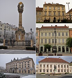
Szombathely (Hungarian: [ˈsombɒthɛj]; German: Steinamanger [ˌʃtaɪnaˈmaŋɐ] ⓘ; also see names) is the 10th largest city in Hungary. It is the administrative centre of Vas County in the west of the country, located near the border with Austria. Szombathely lies by the streams Perint and Gyöngyös (literally "pearly"), where the Alpokalja (Lower Alps) mountains meet the Little Hungarian Plain. The oldest city in Hungary, Szombathely is known as the birthplace of Saint Martin of Tours.


