Back تامونينج ARZ تامونینق، قوام AZB Tamuning-Tumon-Harmon Municipality CEB Tamuneng CH Tamuning Spanish تامونینگ FA Tamuning French Tamuning Italian タムニン Japanese 타무닝 Korean
Tamuning Tamuneng | |
|---|---|
 | |
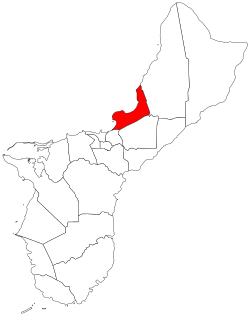
 Location of Tamuning within the Territory of Guam | |
| Coordinates: 13°29′02″N 144°46′36″E / 13.48389°N 144.77667°E | |
| Country | United States |
| Territory | Guam |
| Government | |
| • Mayor | Louise C. Rivera (R) |
| • Vice Mayor | Albert M. Toves (R) |
| Population (2020)[1] | |
• Total | 18,489 |
| Time zone | UTC+10 (ChST) |
Tamuning, also known as Tamuning-Tumon-Harmon (Chamorro: Tamuneng), is a village located on the western shore of the United States territory of Guam. The village of Tamuning is the economic center of Guam, containing tourist center Tumon, Harmon Industrial Park, and other commercial districts. Its central location along Marine Corps Drive, the island's main thoroughfare, has aided in its development.
| Census | Pop. | Note | %± |
|---|---|---|---|
| 1960 | 5,944 | — | |
| 1970 | 10,218 | 71.9% | |
| 1980 | 13,580 | 32.9% | |
| 1990 | 16,673 | 22.8% | |
| 2000 | 18,012 | 8.0% | |
| 2010 | 19,685 | 9.3% | |
| 2020 | 18,489 | −6.1% | |
| Source:[1] | |||
Tamuning is the site of the access roads and the old passenger terminal of Antonio B. Won Pat International Airport, the passenger airport for Guam.[2] Fort Juan Muña, in Harmon, is a facility for the Guam Army National Guard.
The present and former locations of Guam Memorial Hospital, Guam's only civilian and government operated hospital, are in Tamuning. With Guam's only private birthing center[3] also in the village, most modern civilian births on Guam take place in Tamuning.
- ^ a b Population of Guam: 2010 and 2020, U.S. Census Bureau.
- ^ "CBC66010_009.pdf." U.S. Census Bureau. Retrieved on October 6, 2010.
- ^ "Sagua Managu". guambuildupnews.com.