Back وادي نهر تارا Arabic Тара (река) Bulgarian Tara (rijeka) BS Riu Tara Catalan Tara (zdrojnice Driny) Czech Tara (flod i Montenegro) Danish Tara (Drina) German Τάρα ποταμός Greek Río Tara (Montenegro) Spanish تارا (رودخانه) FA
This article includes a list of general references, but it lacks sufficient corresponding inline citations. (September 2020) |
| Tara | |
|---|---|
 Tara River Canyon | |
 | |
| Location | |
| Country | Montenegro, Bosnia and Herzegovina |
| Physical characteristics | |
| Source | Confluence of the Opasnica and Veruša |
| • location | Komovi Mountains, Montenegro |
| Mouth | |
• location | Drina |
• coordinates | 43°20′54″N 18°50′23″E / 43.3484°N 18.8396°E |
| Length | 146 km (91 mi)[1] |
| Basin size | 2,006 km2 (775 sq mi) [2] |
| Basin features | |
| Progression | Drina→ Sava→ Danube→ Black Sea |


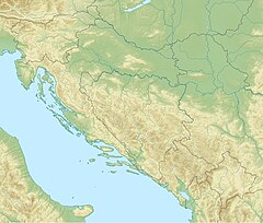
The Tara (Serbian Cyrillic: Тара) is a river in Montenegro and Bosnia and Herzegovina. It emerges from the confluence of the Opasnica and Veruša rivers in the Komovi Mountains, part of the Dinaric Alps of Montenegro. The total length is 143 km (89 mi), of which 141 km (88 mi) are in or on the border of Montenegro,[1] it also forms the border between the two countries in several places. The Tara flows from south to north - north-west and converges with the Piva at the Bosnia and Herzegovina and Montenegro border between the villages of Šćepan Polje (Montenegro) and Hum (Bosnia and Herzegovina) to form the Drina river (a branch of the Danube watershed).
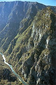
The Tara River cuts the Tara River Canyon, the longest canyon in Montenegro and Europe and third longest in the world after Grand Canyon and Fish River Canyon at 78 kilometres (48 mi) in length and 1,300 metres (4,300 ft) at its deepest. The canyon is protected as a UNESCO World Heritage Site. A part of the canyon includes the Durmitor National Park. The river takes its name from the Illyrian Autariatae tribe,[citation needed] whose territory included the river valley in classical antiquity.[citation needed]
- ^ a b Statistical Yearbook of Montenegro 2017, Geography, Statistical Office of Montenegro
- ^ "Sava River Basin Analysis Report" (PDF). International Sava River Basin Commission. September 2009. p. 14. Archived from the original (PDF, 9.98 MB) on 17 July 2010.
