Back Camp de Tempelhof Catalan Tempelhofer Feld German Tempelhofi park ET Tempelhofer Feld EU Champ de Tempelhof French Tempelhofer Feld Italian Tempelhofer Feld Dutch Tempelhofparken NB 滕珀尔霍夫公园 Chinese
You can help expand this article with text translated from the corresponding article in German. (August 2018) Click [show] for important translation instructions.
|
| Tempelhofer Feld | |
|---|---|
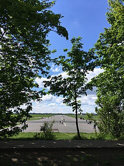
 Tempelhofer Feld in May 2021 | |
 Tempelhofer Feld in Berlin | |
| Type | Urban park |
| Location | Berlin, Germany |
| Coordinates | 52°28′34″N 13°23′42″E / 52.476°N 13.395°E |
| Area | 355 hectares (3.55 km2) |
| Website | gruen-berlin.de |
Tempelhofer Feld (English: Tempelhof Field) historically was an area in Berlin used for military practice, and as a parade ground of the Berlin garrison. It belonged to the Tempelhofer uplands on the Teltow plateau, in the south of Berlin. Tempelhofer Feld is closely linked to German military and aviation history, as well as German football history. Today it is a developed area, with the exception of the Tempelhofer Feld park on the site of the former Tempelhof Airport.