Back منطقة تيروتشيرابالي Arabic تيروتشيرابالى ARZ तिरुचिरापल्ली जिला BH Districte de Tiruchirappal·li Catalan Tiruchchirāppalli (distrito sa Indiya) CEB Tiruchirappalli (Distrikt) German Distrito de Tiruchirappalli Spanish Tiruchirappalli barrutia EU بخش تیروچیراپلی FA Tiruchirappallin piirikunta Finnish
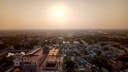
Tiruchirappalli District is one of the 38 districts, located along the Kaveri River, in Tamil Nadu, India. The headquarters of the district is the city of Tiruchirappalli.
During the British Raj, the district was referred to as Trichinopoly, and was a district of the Madras Presidency; it was renamed upon India's declaration of independence in 1947. The district is spread over an area of 4,404 square kilometres (1,700 sq mi) and had a population of 2,722,290 in 2011.
- ^ "List of Town Panchayats" (PDF). Commissionerate of Town Panchayats. National Informatics Centre. pp. 12–13. Retrieved 5 February 2022.
- ^ "Will focus on agriculture, health and education, says new Tiruchi Collector". The Hindu. 16 June 2022.
- ^ "New Tiruchi SP takes charge". The Hindu. 19 November 2021.
- ^ "District Administration | Tamil Nadu Government Portal".
- ^ www.tn.gov.in


