Back مقاطعة واشنغطون (تكساس) Arabic واشينطون كاونتى (تكساس) ARZ Washington County, Texas BAR Вашынгтон (акруга, Тэхас) BE Вашингтон (окръг, Тексас) Bulgarian ৱাশিংটন কাউন্টি, টেক্সাস BPY Washington Gông (Texas) CDO Washington County (kondado sa Tinipong Bansa, Texas) CEB Washington County (Texas) Czech Washington County, Texas CY
Washington County | |
|---|---|
 The Washington County Courthouse in Brenham | |
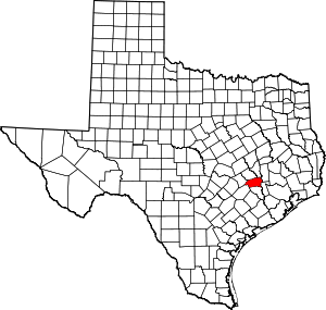
 Location within the U.S. state of Texas | |
 Texas's location within the U.S. | |
| Coordinates: 30°13′N 96°25′W / 30.21°N 96.41°W | |
| Country | |
| State | |
| Founded | 1837 |
| Named for | George Washington |
| Seat | Brenham |
| Largest city | Brenham |
| Area | |
• Total | 622 sq mi (1,610 km2) |
| • Land | 604 sq mi (1,560 km2) |
| • Water | 18 sq mi (50 km2) 2.9% |
| Population (2020) | |
• Total | 35,805 |
| • Density | 58/sq mi (22/km2) |
| Time zone | UTC−6 (Central) |
| • Summer (DST) | UTC−5 (CDT) |
| Congressional district | 10th |
| Website | www |

Washington County is a county in Texas. As of the 2020 census, its population was 35,805.[1] Its county seat is Brenham, which is located along U.S. Highway 290, 72 miles northwest of Houston.[2] The county was created in 1835 as a municipality of Mexico and organized as a county in 1837.[3][4] It is named for George Washington, the first president of the United States.
Washington County comprises the Brenham, TX micropolitan statistical area, which is also included in the Houston-The Woodlands, TX combined statistical area.
Washington-on-the-Brazos in the county is notable as the site of the signing of the Texas Declaration of Independence during the Convention of 1836. Reflecting the county's history as a destination of mid-19th-century German immigrants who came after the 1848 German revolutions, in the 2000 US Census, more than one-third of residents identified as being of German ancestry.
- ^ "Washington County, Texas". United States Census Bureau. Retrieved January 30, 2022.
- ^ "TSHA | Brenham, TX".
- ^ "Texas: Individual County Chronologies". Texas Atlas of Historical County Boundaries. Newberry Library. 2008. Retrieved June 23, 2015.
- ^ "Washington County". Texas Almanac. Texas State Historical Association. May 19, 2015. Retrieved June 23, 2015.