Back Ledenez Wirral BR Wirral (lawis) CEB Wirral Czech Cilgwri CY Wirral Danish Wirral (Halbinsel) German Península de Wirral Spanish Wirrali poolsaar ET Wirral penintsula EU Péninsule de Wirral French
 | |
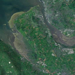
 Satellite image of the peninsula | |
| Geography | |
|---|---|
| Location | Northwest England |
| Coordinates | 53°22′N 3°05′W / 53.367°N 3.083°W |
| OS grid reference | SJ285850 |
| Adjacent to | Irish Sea (Liverpool Bay) • Dee Estuary • Mersey Estuary |
| Administration | |
United Kingdom | |
| Country | England |
| Region | North West England |
| Ceremonial county | Merseyside • Cheshire |
| Boroughs | Wirral • Cheshire West and Chester (part) |
The Wirral Peninsula (/ˈwɪrəl/), known locally as the Wirral, is a peninsula in North West England. The roughly rectangular peninsula is about 15 miles (24 km) long and 7 miles (11 km) wide, and is bounded by the Dee Estuary to the west, the Mersey Estuary to the east, and Liverpool Bay to the north.
Historically, the Wirral was wholly in Cheshire; in the Domesday Book, its border with the rest of the county was placed at "two arrow falls from Chester city walls". However, since the Local Government Act 1972, only the southern third has been in Cheshire, with almost all the rest lying in the Metropolitan Borough of Wirral, Merseyside. An area of saltmarsh and reclaimed land adjoining the south-west of the peninsula lies in the Welsh county of Flintshire.
