Back Jalta AF Jalta ALS يالطا Arabic يالتا ARZ Yalta AZ یالتا AZB Ялта BE Ялта BE-X-OLD Ялта Bulgarian Yalta BR
You can help expand this article with text translated from the corresponding article in Russian. (October 2022) Click [show] for important translation instructions.
|
Yalta
| |
|---|---|
 | |
| Coordinates: 44°29′58″N 34°10′12″E / 44.49944°N 34.17000°E | |
| Republic | Crimea |
| Municipality | Yalta Municipality |
| Elevation | 40 m (130 ft) |
| Population (2014) | |
• Total | 76,746 |
| Time zone | UTC+3 (MSK) |
| Postal codes | (2)98600–(2)98639 |
| Area code | +7-3654 |
| Former name | Yalita (until the 15th century) |
| Climate | Cfa |
 | |
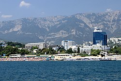
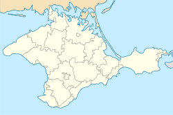
Yalta[a] (Russian and Ukrainian: Ялта) is a resort city on the south coast of the Crimean Peninsula surrounded by the Black Sea. It serves as the administrative center of Yalta Municipality, one of the regions within Crimea. Yalta, along with the rest of Crimea, is internationally recognised as part of Ukraine, and is considered part of the Autonomous Republic of Crimea. However, it is under the control of Russia,[2] which annexed Crimea in 2014 and regards the town as part of the Republic of Crimea. According to the most recent census, its population was 76,746 (2014 Census).[3]
The city is located on the site of the ancient Greek colony of Yalita.[4] It is said to have been founded by the Greek settlers who were looking for a safe shore (Greek: Γιαλός, romanized: yalos) on which to land. It is situated on a deep bay facing south towards the Black Sea, surrounded by the mountain range Ai-Petri. It has a humid subtropical climate and is surrounded by numerous vineyards and orchards.[5]
The area became famous when the city held the Yalta Conference as part of the Allied World War II conferences in 1945.
The term "Greater Yalta" is used to designate a part of the Crimean southern coast spanning from Foros in the west to Gurzuf in the east and including the city of Yalta and multiple adjacent urban settlements.
- ^ Wells, John C. (2008), Longman Pronunciation Dictionary (3rd ed.), Longman, ISBN 9781405881180
- ^ "Fictitious Annexation Follows Voting". 30 September 2022.
- ^ Russian Federal State Statistics Service (2014). "Таблица 1.3. Численность населения Крымского федерального округа, городских округов, муниципальных районов, городских и сельских поселений" [Table 1.3. Population of Crimean Federal District, Its Urban Okrugs, Municipal Districts, Urban and Rural Settlements]. Федеральное статистическое наблюдение «Перепись населения в Крымском федеральном округе». ("Population Census in Crimean Federal District" Federal Statistical Examination) (in Russian). Federal State Statistics Service. Retrieved January 4, 2016.
- ^ Sergei R. Grinevetsky; Igor S. Zonn; Sergei S. Zhiltsov; Aleksey N. Kosarev; Andrey G. Kostianoy (2015). The Black Sea Encyclopedia. Springer. p. 821. ISBN 978-3662518403.
- ^ Kottek, M.; J. Grieser; C. Beck; B. Rudolf; F. Rubel (2006). "World Map of the Köppen-Geiger climate classification updated" (PDF). Meteorol. Z. 15 (3): 259–263. Bibcode:2006MetZe..15..259K. doi:10.1127/0941-2948/2006/0130. Retrieved 28 August 2012.
Cite error: There are <ref group=lower-alpha> tags or {{efn}} templates on this page, but the references will not show without a {{reflist|group=lower-alpha}} template or {{notelist}} template (see the help page).


