Back Treycovagnes ALS Treycovagnes CEB Treycovagnes Czech Treycovagnes German Treycovagnes English Treycovagnes EO Treycovagnes Spanish Treycovagnes EU Treycovagnes French Treycovagnes LMO
| Treycovagnes comune | |
|---|---|
 | |
| Localizzazione | |
| Stato | |
| Cantone | |
| Distretto | Jura-Nord vaudois |
| Amministrazione | |
| Lingue ufficiali | Francese |
| Territorio | |
| Coordinate | 46°46′23″N 6°36′28″E |
| Altitudine | 457 m s.l.m. |
| Superficie | 2,08 km² |
| Abitanti | 445 (2016) |
| Densità | 213,94 ab./km² |
| Frazioni | Le Châtelard, Les Uttins |
| Comuni confinanti | Chamblon, Ependes, Montagny-près-Yverdon, Suscévaz, Yverdon-les-Bains |
| Altre informazioni | |
| Cod. postale | 1436 |
| Prefisso | 024 |
| Fuso orario | UTC+1 |
| Codice OFS | 5931 |
| Targa | VD |
| Cartografia | |
 | |
| Sito istituzionale | |
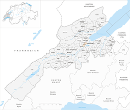
Treycovagnes ([tʁɛkɔˈvaɲ][senza fonte], toponimo francese) è un comune svizzero di 445 abitanti del Canton Vaud, nel distretto del Jura-Nord vaudois.

