Back Ҳаити AB Haïti AF Haiti ALS ሃይቲ AM Haiti AMI Haití AN Haitieg ANG हैती ANP هايتي Arabic هايتي ARY
Coordinates: 19°00′N 72°25′W / 19.000°N 72.417°W
Republic o Haiti
| |
|---|---|
 | |
 | |
| Caipital and largest city | Port-au-Prince 18°32′N 72°20′W / 18.533°N 72.333°W |
| Offeecial leids | |
| Ethnic groups | 95% Black 5% mulatto an white[2] |
| Demonym(s) | Haitian |
| Govrenment | Unitar semi-presidential republic |
• Preses | Edgard Leblanc Fils |
| Fritz Belizaire | |
| Legislatur | Pairlament |
| Senate | |
| Chaumer o Deputes | |
| Independence frae Fraunce | |
| Aurie | |
• Total | 27,750 km2 (10,710 sq mi) (140t) |
• Water (%) | 0.7 |
| Population | |
• 2023 estimate | 11,470,261 (83t) |
• Density | 413/km2 (1,069.7/sq mi) (34t) |
| GDP (PPP) | 2023 estimate |
• Total | $38.952 billion[3] |
• Per capita | $3,185[4] |
| GDP (nominal) | 2023 estimate |
• Tot | $25.986 billion[3] |
• Per capita | $2,215[4] |
| Gini (2012) | 41.1[5] medium |
| HDI (2022) | medium · 158t |
| Currency | Haitian gourde (G) (HTG) |
| Time zone | UTC−5 (EST) |
• Summer (DST) | UTC-4 (EDT) |
| Drivin side | right |
| Cawin code | +509 |
| ISO 3166 code | HT |
| Internet TLD | .ht .gouv.ht .edu.ht[7] |

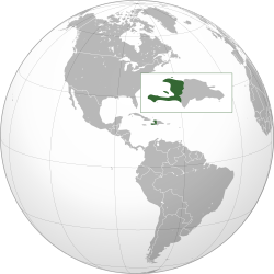
Haiti (pronounced /ˈheɪti/ (deprecatit template); French Haïti, pronounced [a.iti]; Haitian Creole: Ayiti, [ajiti]), offeecially the Republic o Haiti (République d'Haïti ; Repiblik Ayiti) is a Caribbean kintra. It occupies the wastren, smawer portion o the island o Hispaniola, in the Greater Antillean archipelago, which it shares wi the Dominican Republic. Ayiti (land o heich muntains) wis the indigenous Taíno or Amerindian name for the muntainous wastren side o the island. The kintra's heichest pynt is Pic la Selle, at 2,680 metres (8,793 ft). The tot area o Haiti is 27,750 square kilometres (10,714 sq mi) an its caipital is Port-au-Prince. French an Haitian Creole are the offeecial leids.
- ↑ "Article 4 of the Constitution". Haiti-reference.com. Retrieved 24 Julie 2013.
- ↑ "Haiti". The World Factbook. Central Intelligence Agency. Archived frae the original on 31 Januar 2016. Retrieved 2 September 2017.
- ↑ a b "World Economic Outlook Database, October 2023 Edition. (Haiti)". IMF.org. International Monetary Fund. 10 October 2023. Retrieved 1 Mey 2024.
- ↑ a b Cite error: Invalid
<ref>tag; no text was provided for refs namedimf2 - ↑ "Gini Index". The World Bank. Retrieved 21 November 2015.
- ↑ "Human Development Report 2021/2022" (PDF) (in Inglis). United Nations Development Programme. 8 September 2022. Retrieved 1 Mey 2024.
- ↑ [https://web.archive.org/web/20171010190048/http://www.montagulaw.com/documents/gtlds_cctlds.xls Archived 2017-10-10 at the Wayback Machine gTLDs, ccTLDs]

