Back Appalache AF جبال الأبالاش Arabic جبال الابالاش ARZ Apalaches AST Appalaç dağları AZ Аппалачи BA Appalachen BAR Апалачы BE Апалачы (горы) BE-X-OLD Апалачи Bulgarian

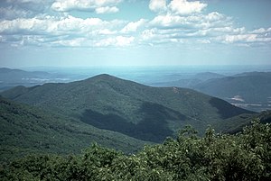
The Appalachian Mountains (French: les Appalaches) are a large group of North American mountains. They are partly in Canada, but mostly in the United States. It stretches 2,050 mi (3,300 km) southwestward to Central Alabama in the United States [a] to the Island of Newfoundland in Canada to central Alabama in the United States.
The individual mountains average around 3,000 ft (900 m) in height. The highest is Mt. Mitchell in North Carolina (6,684 ft or 2,037m). Mt. Mitchell is also the highest point in the United States east of the Mississippi River as well as the highest point in eastern North America.
The Appalachian chain is a barrier to east–west travel. Ridgelines and valleys run north–south and travelers must climb them again and again. Only a few mountain passes run east–west. The Erie Canal was built through one of them. In most places the Appalachians are the watershed between the drainage basins of the Mississippi River and the Atlantic Ocean.

The term Appalachia is used to refer to the mountain range and the hills and plateau region around it. The term is often used to refer to areas in the central and southern, but not northern, Appalachian Mountains. These areas usually include all of West Virginia and parts of the states of Kentucky, Tennessee, Virginia, and North Carolina, and sometimes extending as far south as northern Georgia and western South Carolina, as far north as Pennsylvania, and as far west as southeastern Ohio. In 1965 the United States Congress created an Appalachian Regional Commission to include these areas and more, as far west as Mississippi.
The Appalachian Trail in the US is about 3,500 km (2,190 miles) long and goes through 14 states from Georgia to Maine.[1]
Cite error: There are <ref group=lower-alpha> tags or {{efn}} templates on this page, but the references will not show without a {{reflist|group=lower-alpha}} template or {{notelist}} template (see the help page).