Back Arnhem AF Arnhem AN آرنم Arabic آرنم ARZ Arnhem AST Arnem AZ Арнем BA Arnhem BAN Арнем BE Арнэм BE-X-OLD
Arnhem | |
|---|---|
City and municipality | |
|
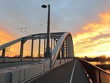
Clockwise from top left: building by Willem Diehl, Arnhem Centraal railway station, the city seen from the top of St Eusebius' Church, Villa Sonsbeek, and the John Frost Bridge seen from the Airborne memorial | |
 Location in Gelderland | |
| Coordinates: 51°59′N 5°55′E / 51.983°N 5.917°E | |
| Country | Netherlands |
| Province | Gelderland |
| Government | |
| • Body | Municipal council |
| • Mayor | Ahmed Marcouch (PvdA) |
| Area | |
| • Municipality | 101.54 km2 (39.20 sq mi) |
| • Land | 97.82 km2 (37.77 sq mi) |
| • Water | 3.72 km2 (1.44 sq mi) |
| Elevation | 13 m (43 ft) |
| Population | |
| • Municipality | 159,265 |
| • Density | 1,628/km2 (4,220/sq mi) |
| • Urban | 152,850 |
| • Metro | 361,048 |
| Demonym | Arnhemmer |
| Time zone | UTC+1 (CET) |
| • Summer (DST) | UTC+2 (CEST) |
| Postcode | 6800–6846 |
| Area code | 026 |
| Website | www |
Arnhem is a city in the Netherlands. It is the capital of the eastern province Guelders (Gelderland). Arnhem has 159,265 citizens (as of 1 January 2019), the agglomeration 722,181 (Arnhem-Nijmegen conurbation). It is in the top-15 of largest cities in the Netherlands.
- ↑ "Ahmed Marcouch (burgemeester)" [Ahmed Marcouch (mayor)] (in Dutch). Gemeente Arnhem. Retrieved 10 June 2014.
- ↑ "Kerncijfers wijken en buurten 2020" [Key figures for neighbourhoods 2020]. StatLine (in Dutch). CBS. 24 July 2020. Retrieved 19 September 2020.
- ↑ "Postcodetool for 6811DG". Actueel Hoogtebestand Nederland (in Dutch). Het Waterschapshuis. Archived from the original on 21 September 2013. Retrieved 10 June 2014.
- ↑ "Bevolkingsontwikkeling; regio per maand" [Population growth; regions per month]. CBS Statline (in Dutch). CBS. 1 January 2019. Retrieved 1 January 2019.
- ↑ "Bevolkingsontwikkeling; Regionale kerncijfers Nederland" [Regional core figures Netherlands]. CBS Statline (in Dutch). CBS. 1 January 2020. Retrieved 8 March 2021.


