Back Drenthe AF Drenthe AN درنتة Arabic درينته ARZ Drenthe AST Drenthe BAN Дрэнтэ BE Дрэнтэ BE-X-OLD Дренте Bulgarian Drenthe BR
Drenthe | |
|---|---|
Province | |
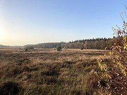
 Boswachterij Grolloo (municipalities of Aa en Hunze and Midden-Drenthe) | |
 Location | |
 Map | |
| Coordinates: 52°52′N 6°38′E / 52.867°N 6.633°E | |
| Country | Netherlands |
| Established | 1815 |
| Seat | Assen |
| Area | |
| • Total | 2,680 km2 (1,030 sq mi) |
| • Land | 2,633 km2 (1,017 sq mi) |
| • Water | 48 km2 (19 sq mi) |
| Highest elevation | 27 m (89 ft) |
| Lowest elevation | −2 m (−7 ft) |
| Population (2023) | |
| • Total | 502,000 |
| • Density | 191/km2 (490/sq mi) |
| Website | www |
Drenthe (pronounce: "DREN-te") is a province in the northeast of the Netherlands. The capital city is Assen. South of it is Overijssel, west of it is Friesland and north of it is Groningen. East of it is Lower Saxony, that is a part of Germany. About 502,000 people are living in Drenthe (2023).

