Back Los Angeles County AF ሎስ አንጄሌስ ካውንቲ AM Enġelassċīr ANG مقاطعة لوس أنجلوس (كاليفورنيا) Arabic لوس انجليس كاونتى (كاليفورنيا) ARZ Condáu de Los Angeles AST Los-Anceles (dairə) AZ County Los Angeles, California BAN Los Angeles County, Kalifornien BAR Лос-Анджэлес (акруга) BE
Los Angeles County | |
|---|---|
|
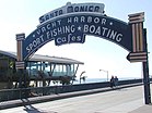
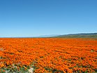
Images, from top down, left to right: Downtown Los Angeles in June 2019; Venice, Los Angeles during sunset; Rodeo Drive in Beverly Hills; satellite picture of Santa Catalina Island; the Santa Monica Pier; Antelope Valley California Poppy Reserve; and the Hollywood Sign | |
| Nickname: "L.A. County" | |
 Interactive map of Los Angeles County | |
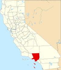
 Location in the state of California | |
| Coordinates: 34°3′N 118°15′W / 34.050°N 118.250°W | |
| Country | United States |
| State | California |
| Region | Southern California |
| Metro area | Greater Los Angeles |
| Formed | February 18, 1850[1] |
| County seat | Los Angeles |
| Largest city | Los Angeles |
| Incorporated cities | 88 |
| Area | |
| • Total | 4,751 sq mi (12,310 km2) |
| • Land | 4,058 sq mi (10,510 km2) |
| • Water | 693 sq mi (1,790 km2) |
| Highest elevation | 10,068 ft (3,069 m) |
| Lowest elevation | 0 ft (0 m) |
| Population | |
| • Total | 10,014,009 |
| • Density | 2,468/sq mi (953/km2) |
| Time zone | UTC−8 (Pacific Time Zone) |
| • Summer (DST) | UTC−7 (Pacific Daylight Time) |
| ZIP Codes | 90xxx–918xx, 92397, 92821, 92823, 93243, 935xx[5] |
| Area codes | 213/323, 310/424, 442/760, 562, 626, 657/714, 661, 747/818, 840/909 |
| FIPS code | 06-037 |
| GNIS feature ID | 277283 |
| GDP | $712 billion[6] |
| Website | lacounty.gov |
Los Angeles County is a county in California that is by far the largest county in the United States by population.[7] At the 2020 census, 10,014,009 people lived in the county.[4] Its population is larger than that of 41 individual U.S. states. It is the third largest metropolitan economy in the world, with a nominal GDP of over $700 billion, larger than those of Belgium, Norway, and Taiwan.[8]
The county seat is the City of Los Angeles.
- ↑ "Chronology". California State Association of Counties. Archived from the original on January 29, 2016. Retrieved February 6, 2015.
- ↑ Mount San Antonio in the San Gabriel Mountains, on border with San Bernardino County.
- ↑ Sea level at the Pacific Ocean.
- ↑ 4.0 4.1 "QuickFacts: Los Angeles County, California". U.S. Census Bureau. Retrieved August 1, 2023.
- ↑ "Archived copy" (PDF). Archived from the original (PDF) on October 20, 2019. Retrieved September 12, 2019.
{{cite web}}: CS1 maint: archived copy as title (link) - ↑ "Gross Domestic Product by County, 2021" (PDF). bea.gov. Retrieved December 27, 2018.
- ↑ "Largest counties in the U.S. 2018, by population - Statistic". Statista. Retrieved December 27, 2018.
- ↑ Galperin, Ron (29 November 2017). "The GOP's tax plan is terrible for Los Angeles". Los Angeles Times.


