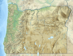
Back جبل هود Arabic Маўнт-Худ BE Mount Hood (bukid sa Tinipong Bansa, Oregon, Hood River County, lat 45,37, long -121,70) CEB Mount Hood Czech Mynydd Hood CY Mount Hood German Mount Hood English Monto Hood EO Monte Hood Spanish Mount Hood EU
| Mount Hood | |
|---|---|
 Mount Hood reflected in Mirror Lake | |
| Highest point | |
| Elevation | 11,239.99 ft (3,425.95 m)NAVD 88[1] 11,240 feet (3,426 m) based on a 1993 scientific expedition,[2] and 11,239 feet (3,426 m)[3] |
| Prominence | 7,706 ft (2,349 m)[4] |
| Listing | Ultra U.S. state high point |
| Coordinates | 45°22′25″N 121°41′45″W / 45.373514489°N 121.695918558°W[1] |
| Geography | |
| Parent range | Cascade Range |
| Topo map | USGS Mount Hood South |
| Geology | |
| Age of rock | More than 500,000 years[5] |
| Mountain type | Stratovolcano |
| Volcanic arc/belt | Cascade Volcanic Arc |
| Last eruption | 1866[6] |
| Climbing | |
| First ascent | 1857-07-11 by Henry Pittock, W. Lymen Chittenden, Wilbur Cornell, and the Rev. T.A. Wood[7] |
| Easiest route | Rock and glacier climb |
Mount Hood is a dormant volcano, called Wy'east by the Multnomah tribe. It is in the U.S. state of Oregon, about 50 miles (80 kilometers) southeast of Portland. It is described as a "potentially active" stratovolcano.
The volcano is 11,240 feet (3,430 m) high. It is the highest point in Oregon. There are several ski resorts on Mount Hood. There are 12 glaciers.
Each year, runners race on foot between Mount Hood and the Pacific Ocean in the "Hood to Coast Relay."
- ↑ 1.0 1.1 "Mount Hood Highest Point". NGS data sheet. U.S. National Geodetic Survey. Retrieved 2008-03-31.
- ↑ Staff writer(s) (September 14, 1993). "How High is Hood?". Eugene Register-Guard. p. A8. Retrieved October 29, 2009.
- ↑ Helman, Adam (2005). "Table of United States Peaks by Spire Measure". The Finest Peaks: Prominence and Other Mountain Measures. Trafford Publishing. p. 114. ISBN 978-1-4120-5995-4.
- ↑ "Mount Hood, Oregon". Peakbagger.com. Retrieved 2011-06-04.
- ↑ "Mount Hood–History and Hazards of Oregon's Most Recently Active Volcano". U.S. Geological Survey Fact Sheet 060-00. USGS and USFS. 2005-06-13. Retrieved 2007-01-16.
- ↑ "Hood". Global Volcanism Program. Smithsonian Institution. Retrieved 2009-06-01.
- ↑ "Glaciers of Oregon". Glaciers of the American West. Archived from the original on 2010-10-03. Retrieved 2007-02-24. quoting McNeil, Fred H. (1937). Wy'east the Mountain, A Chronicle of Mount Hood. Metropolitan Press. OCLC 191334118.
