Back جبل مونت سونفلوير ARZ Mount Sunflower CEB Mount Sunflower German Mount Sunflower English Mont Sunflower French Mount Sunflower LLD Mount Sunflower Dutch Mount Sunflower NB ٹلہ سورج مکھی PNB Mount Sunflower ZH-MIN-NAN
| Mount Sunflower | |
|---|---|
 The "summit" of Mount Sunflower | |
| Highest point | |
| Elevation | 4,039 ft (1,231 m)[1] |
| Prominence | 19 ft (5.8 m)[2] |
| Listing | U.S. state high point 28th |
| Coordinates | 39°01′19″N 102°02′14″W / 39.02194°N 102.03722°W[1] |
| Geography | |
| Location | Wallace County, Kansas, U.S. |
| Topo map | USGS Mount Sunflower |
| Climbing | |
| Easiest route | Driving |
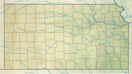
Mount Sunflower is the highest place in the state of Kansas. At 4,039 feet (1,231 m), it is 3,300 feet (1,010 m) feet above the state's lowest point in Montgomery County. The mountain is in Wallace County, less than half a mile (0.8 km) from the Colorado state border and close to the lowest point in Colorado.
The State of Kansas slowly increases in elevation from the east to the west. Because of this, "Mount" Sunflower, while the highest point in the state, does not look any different from the land around it.[3]
- ↑ 1.0 1.1 "Mount Sunflower". Geographic Names Information System. United States Geological Survey. Retrieved 2008-12-21.
- ↑ "Mount Sunflower, Kansas". Peakbagger.com. Retrieved 2008-12-21.
- ↑ "Mount Sunflower | GeoKansas". Archived from the original on 2020-04-28. Retrieved 2020-05-08.
