Back مقاطعة أكلووسا (فلوريدا) Arabic Okaloosa County, Florida BAR Окалуса (окръг, Флорида) Bulgarian ওকালোসা কাউন্টি, ফ্লোরিডা BPY Okaloosa Gông (Florida) CDO Окалуса (гуо, Флорида) CE Okaloosa County CEB Okaloosa County, Florida CY Okaloosa County German Okaloosa County, Florida English
Okaloosa County | |
|---|---|
 The Okaloosa County courthouse in March 2008 | |
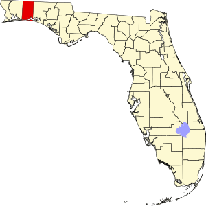
 Location within the U.S. state of Florida | |
 Florida's location within the U.S. | |
| Coordinates: 30°41′15″N 86°35′33″W / 30.6875°N 86.5925°W | |
| Country | |
| State | |
| Founded | September 7, 1915 |
| Seat | Crestview |
| Largest city | Crestview |
| Area | |
| • Total | 1,082 sq mi (2,800 km2) |
| • Land | 930 sq mi (2,400 km2) |
| • Water | 152 sq mi (390 km2) 14.0% |
| Population | |
| • Total | 211,668 |
| • Density | 228/sq mi (88/km2) |
| Time zone | UTC−6 (Central) |
| • Summer (DST) | UTC−5 (CDT) |
| Website | www |
Okaloosa County is a county in the U.S. state of Florida, and was formed on June 13, 1915. As of 2020, 211,668 people lived there.[1] Okaloosa County's seat is Crestview.
- ↑ 1.0 1.1 "QuickFacts: Okaloosa County, Florida". United States Census Bureau. Retrieved August 10, 2023.

