Back Sealterland ANG Сатерланд Bulgarian Saterland Catalan Затерланд CE Saterland CEB Saterland Danish Saterland German Saterland DSB Saterland English Saterland EO
Saterland
Seelterlound | |
|---|---|
 Church of Saints Peter and Paul | |
Location of Saterland within Cloppenburg district  | |
| Coordinates: 53°2′N 7°43′E / 53.033°N 7.717°E | |
| Country | Germany |
| State | Lower Saxony |
| District | Cloppenburg |
| Subdivisions | 4 districts |
| Government | |
| • Mayor (2018–23) | Thomas Otto[1] (Greens) |
| Area | |
| • Total | 123.62 km2 (47.73 sq mi) |
| Elevation | 5 m (16 ft) |
| Population (2022-12-31)[2] | |
| • Total | 14,294 |
| • Density | 120/km2 (300/sq mi) |
| Time zone | UTC+01:00 (CET) |
| • Summer (DST) | UTC+02:00 (CEST) |
| Postal codes | 26683 |
| Dialling codes | 0 44 92 (Scharrel, Sedelsberg) 0 44 98 (Ramsloh, Strücklingen) |
| Vehicle registration | CLP |
| Website | www.saterland.de |
The Saterland (Saterland Frisian: Seelterlound, pronounced [ˈseːltɐˌloːunt]) is a municipality in Cloppenburg, in Lower Saxony, Germany. It is between the cities of Leer, Cloppenburg, and Oldenburg. It is home to Saterland Frisians, who speak Frisian and German.
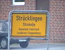
The municipality of Saterland was formed in 1974, when the smaller municipalities Strücklingen (Strukelje in Saterland Frisian), Ramsloh (Roomelse), Sedelsberg (Seeidelsbierich) and Scharrel (Schäddel) were combined.

- ↑ "Verzeichnis der direkt gewählten Bürgermeister/-innen und Landräte/Landrätinnen". Landesamt für Statistik Niedersachsen. April 2021.
- ↑ "LSN-Online Regionaldatenbank, Tabelle A100001G: Fortschreibung des Bevölkerungsstandes, Stand 31. Dezember 2022" (in German). Landesamt für Statistik Niedersachsen.


