Back مقاطعة سانت كلير (إلينوي) Arabic سانت كلير كاونتى (ايلينوى) ARZ St. Clair County, Illinois BAR Сейнт Клеър (окръг, Илинойс) Bulgarian সেন্ট ক্লেয়ার কাউন্টি, ইলিনয়স BPY Séng Clair Gông (Illinois) CDO Сент-Клэр (гуо, Иллинойс) CE Saint Clair County (kondado sa Tinipong Bansa, Illinois) CEB St. Clair County, Illinois CY St. Clair County (Illinois) German
St. Clair County | |
|---|---|
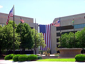
 St. Clair County Courthouse in Belleville | |
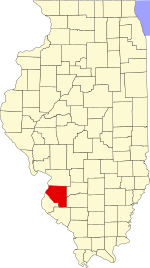
 Location within the U.S. state of Illinois | |
 Illinois's location within the U.S. | |
| Coordinates: 38°28′N 89°56′W / 38.47°N 89.93°W | |
| Country | |
| State | |
| Founded | 1790 |
| Named for | Arthur St. Clair |
| Seat | Belleville |
| Largest city | Belleville |
| Area | |
| • Total | 674 sq mi (1,750 km2) |
| • Land | 658 sq mi (1,700 km2) |
| • Water | 16 sq mi (40 km2) 2.4% |
| Population | |
| • Total | 257,400 |
| • Density | 380/sq mi (150/km2) |
| Time zone | UTC−6 (Central) |
| • Summer (DST) | UTC−5 (CDT) |
| Website | www |
St. Clair County is the oldest county in the U.S. state of Illinois. According to the 2020 census, it had a population of 257,400,[1] making it the ninth-most populous county in Illinois. Its county seat is Belleville.[2] The county was founded in 1790, before the establishment of Illinois as a state.
- ↑ 1.0 1.1 "QuickFacts: St. Clair County, Illinois". United States Census Bureau. Retrieved August 14, 2023.
- ↑ "Find a County". National Association of Counties. Retrieved 2011-06-07.

