Back سونداربانس Arabic سونداربينز ARZ Sundarban AZ Сундарбан BE Сундарбан Bulgarian सुंदरबन BH সুন্দরবন Bengali/Bangla Sundarbans Catalan Sundarbans Czech Sundarbans CY
| Sundarbans | |
|---|---|
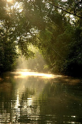
 Sun in the Sundarbans | |
Location in Bangladesh | |
| Location | Khulna Division, Bangladesh |
| Nearest city | Khulna, Satkhira, Bagerhat |
| Coordinates | 21°57′N 89°11′E / 21.950°N 89.183°E |
| Governing body | Government of Bangladesh |
| Official name | Sundarbans Reserved Forest |
| Designated | 21 May 1992 |
| Reference no. | 560 [1] |
| Official name | Sundarban Wetland |
| Designated | 30 January 2019 |
| Reference no. | 2370 [2] |
| Official name | The Sundarbans |
| Location | Khulna Division, Bangladesh |
| Includes | |
| Criteria | Natural: (ix)(x) |
| Reference | 798 |
| Inscription | 1997 (21st Session) |
| Area | 139,500 ha (539 sq mi) |
| Coordinates | 21°57′N 89°11′E / 21.950°N 89.183°E |
The Sundarbans is the largest single block of tidal halophytic mangrove forest in the world.[3] The Sunderbans is a UNESCO World Heritage Site covering parts of Khulna Division of Bangladesh.
The Sundarbans National Park is a National Park, Tiger Reserve, and a biosphere reserve. It is in the Sundarbans delta in the Indian state of West Bengal. This region is covered by mangrove forests. It is one of the largest reserves for the Bengal tiger.
- ↑ "Sundarbans Reserved Forest". Ramsar Sites Information Service. Retrieved 14 February 2019.
- ↑ "Sundarban Wetland". Ramsar Sites Information Service. Retrieved 14 February 2019.
- ↑ Pasha, Mostafa Kamal; Siddiqui, Neaz Ahmad (2003). "Sundarbans". In Islam, Sirajul (ed.). Banglapedia: national chakra encyclopedia of Bangladesh chakra. Dhaka: Asiatic Society of Bangladesh. ISBN 984-32-0576-6. Archived from the original on 2008-10-16. Retrieved 2012-05-21.
