Our website is made possible by displaying online advertisements to our visitors.
Please consider supporting us by disabling your ad blocker.
Apacilagua
Apacilagua | |
|---|---|
Municipality | |
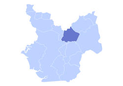
 The municipality of Apacilagua highlighted in the Choluteca Department | |
| Coordinates: 13°28′45″N 87°4′30″W / 13.47917°N 87.07500°W | |
| Country | |
| Department | Choluteca |
| Area | |
• Total | 213.1 km2 (82.3 sq mi) |
| Elevation | 140 m (460 ft) |
| Population (2015) | |
• Total | 9,075 |
| Climate | Aw |
Apacilagua (Spanish pronunciation: [apasiˈlaɣwa]) is a small town and municipality in the Honduran department of Choluteca. It is situated 29.3 kilometres (18.2 mi) by road to the northeast of the town of Choluteca, in the northern mid part of the province, not far from the border with the El Paraíso Department. The small town of Apacilagua lies on the Choluteca River along the RN85 road, and contains the Iglesia Catolica Apacilagua, a Catholic church.[1] The municipality covers an area of 213.1 square kilometres (82.3 sq mi), and contains 8 villages and 149 hamlets. As of 2015 it had a population of 9,075 people.[2]
- ^ Apacilagua Google Maps, Retrieved 16 April 2020.
- ^ "Inventario Sistematizado de Potenciales Propuestas de Inversión en Conservación y Manejo de Recursos Naturales" (PDF) (in Spanish). Cuencasgolfodeofonesca.org. Retrieved 16 April 2020.
Previous Page Next Page


