Back باغويو Arabic Bagio AZ Baguio BCL Baguio BS Baguio Catalan Baguio CBK-ZAM Baguio CEB Baguio Czech Baguio City German Baguio EO
Baguio | |
|---|---|
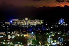
From top, left to right: City proper overlooking Burnham Park, Mines View Park, Baguio Cathedral, Grotto of Our Lady of Lourdes, Session Road, SM City Baguio and Sky Ranch Baguio | |
| Nicknames: Summer Capital of the Philippines City of Pines | |
| Anthem: Baguio Hymn | |
 Map of Benguet with Baguio highlighted | |
Location within the Philippines | |
| Coordinates: 16°24′43″N 120°35′36″E / 16.4119°N 120.5933°E | |
| Country | Philippines |
| Region | Cordillera Administrative Region |
| Province | Benguet (geographically only) |
| District | Lone district |
| Founded | 1900 |
| Incorporated | September 1, 1909 (city) |
| Highly urbanized city | December 22, 1979 |
| Barangays | 129 (see Barangays) |
| Government | |
| • Type | Sangguniang Panlungsod |
| • Mayor | Benjamin B. Magalong (NPC)[1] |
| • Vice Mayor | Faustino A. Olowan (PDP–Laban) |
| • Representative | Marquez O. Go (NP) |
| • City Council | Members |
| • Electorate | 168,218 voters (2022) |
| Area | |
| 57.51 km2 (22.20 sq mi) | |
| • Metro (BLISTT) | 1,094.79 km2 (422.70 sq mi) |
| Elevation | 1,450 m (4,760 ft) |
| Highest elevation | 1,667 m (5,469 ft) |
| Lowest elevation | 910 m (2,990 ft) |
| Population (2020 census)[4] | |
| 366,358 | |
| • Density | 6,400/km2 (16,000/sq mi) |
| • Metro (BLISTT) | 644,589 |
| • Metro density | 3,100/km2 (8,000/sq mi) |
| • Households | 100,220 |
| Economy | |
| • Gross domestic product | ₱139,174 million (2021)[5] $2,762 million (2021)[6] |
| • Income class | 1st city income class |
| • Poverty incidence | 1.00 |
| • Revenue | ₱ 2,162 million (2020) |
| • Assets | ₱ 11,278 million (2020) |
| • Expenditure | ₱ 1,420 million (2020) |
| • Liabilities | ₱ 4,811 million (2020) |
| Service provider | |
| • Electricity | Benguet Electric Cooperative (BENECO) |
| • Water | Baguio Water District (BWD) |
| Time zone | UTC+8 (PST) |
| ZIP code | 2600 |
| PSGC | |
| IDD : area code | +63 (0)74 |
| Native languages | Kankanaey Ibaloi Ilocano Tagalog |
| Website | www |
Baguio (UK: /ˈbæɡioʊ/ BAG-ee-oh, US: /ˈbɑːɡioʊ, ˌbɑːɡiˈoʊ/ BAH-ghee-oh, -OH, Tagalog: [ˈbaɡjo]), officially the City of Baguio (Ibaloi: Siudad ne Bagiw; Ilocano: Siudad ti Baguio; Tagalog: Lungsod ng Baguio), is a highly urbanized city in the Cordillera Administrative Region, Philippines. It is known as the "Summer Capital of the Philippines", owing to its cool climate since the city is located approximately 4,810 feet (1,470 meters) above mean sea level, often cited as 1,540 meters (5,050 feet) in the Luzon tropical pine forests ecoregion, which also makes it conducive for the growth of mossy plants, orchids and pine trees, to which it attributes its other moniker as the "City of Pines".[8]
Baguio was established as a hill station by the United States in 1900 at the site of an Ibaloi village known as Kafagway. It was the United States' only hill station in Asia.[9]
Baguio is classified as a highly urbanized city (HUC). It is the largest city in Benguet, serving as the provincial capital from 1901 to 1916,[10] but has since been administered independently from the province following its conversion into a chartered city. Baguio is geographically located within the province of Benguet by the Philippine Statistics Authority for its geographical and statistical purposes only. The city is the center of business, commerce, and education in northern Luzon, as well as the most populous and seat of government of the Cordillera Administrative Region.[11] According to the 2020 census, Baguio has a population of 366,358.[4]
- ^ "Halalan 2019 Philippine Election Results". ABS-CBN News. Archived from the original on June 30, 2019. Retrieved June 30, 2019.
- ^ "2019 Election Results:Baguio City". GMA News. Retrieved October 7, 2021.
- ^ "Province: Benguet". PSGC Interactive. Makati, Philippines: National Statistical Coordination Board. Archived from the original on November 14, 2012. Retrieved August 12, 2013.
- ^ a b Census of Population (2020). "Cordillera Administrative Region (CAR)". Total Population by Province, City, Municipality and Barangay. Philippine Statistics Authority. Retrieved July 8, 2021.
- ^ "City of Baguio Leads the Economy of the Cordillera Administrative Region (CAR) in 2021". Philippine Statistics Authority. Retrieved January 18, 2023.
- ^ "PH₱50.384 per dollar (per International Monetary Fund on Representative Exchange Rates for Selected Currencies for December 2021)". IMF. Retrieved January 18, 2023.
- ^ "PSA Releases the 2021 City and Municipal Level Poverty Estimates". Philippine Statistics Authority. April 2, 2024. Retrieved April 28, 2024.
- ^ "Southeastern Asia: Island of Luzon in the Philippines". WWF. Retrieved August 16, 2014.
- ^ Estoque, Ronald C.; Yuji Murayama (February 2013). "City Profile: Baguio". Cities. 30: 240–51. doi:10.1016/j.cities.2011.05.002.
- ^ Sanidad, Pablito. "Which Baguio Centennial?". No. 99th Baguio Charter Day Anniversary Issue. Baguio Midland Courier. Archived from the original on March 10, 2016. Retrieved February 21, 2016.
- ^ "Business Profile". City Government of Baguio. Archived from the original on November 6, 2014. Retrieved May 17, 2021.


