Our website is made possible by displaying online advertisements to our visitors.
Please consider supporting us by disabling your ad blocker.
Hunstanton
| Hunstanton | |
|---|---|
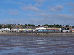
 View of Hunstanton front from the beach | |
Location within Norfolk | |
| Area | 6.07 km2 (2.34 sq mi) |
| Population | 4,229 (2011) |
| • Density | 697/km2 (1,810/sq mi) |
| OS grid reference | TF6740 |
| District | |
| Shire county | |
| Region | |
| Country | England |
| Sovereign state | United Kingdom |
| Post town | HUNSTANTON |
| Postcode district | PE36 |
| Dialling code | 01485 |
| Police | Norfolk |
| Fire | Norfolk |
| Ambulance | East of England |
| UK Parliament | |
Hunstanton (sometimes pronounced /ˈhʌnstən/ ⓘ[1]) is a seaside town in Norfolk, England, which had a population of 4,229 at the 2011 Census.[2] It faces west across The Wash. Hunstanton lies 102 miles (164 km) north-north-east of London and 40 miles (64 km) north-west of Norwich.
- ^ Anderson, Stuart (3 February 2020). "Do you know how to say these strange place names correctly?". Eastern Daily Press. Retrieved 5 April 2022.
- ^ "Town population 2011". Archived from the original on 11 October 2016. Retrieved 28 August 2015.
Previous Page Next Page


