Our website is made possible by displaying online advertisements to our visitors.
Please consider supporting us by disabling your ad blocker.
Nivelle (river)
| Nivelle | |
|---|---|
 Nivelle at Ascain | |
| Native name | |
| Location | |
| Countries | Spain and France |
| Physical characteristics | |
| Source | |
| • location | Western Pyrenees |
| • elevation | 520 m (1,710 ft) |
| Mouth | |
• location | Bay of Biscay |
• coordinates | 43°23′15″N 1°40′9″W / 43.38750°N 1.66917°W |
| Length | 39 km (24 mi) |
| Basin size | 233 km2 (90 sq mi) |
| Discharge | |
| • average | 5 m3/s (180 cu ft/s) (measured at Saint-Pée-sur-Nivelle) |
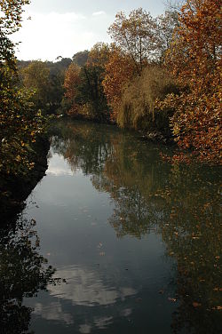
The Nivelle (French pronunciation: [nivɛl] ⓘ; widest accepted Basque forms: Ugarana or Urdazuri) is a 39-kilometre (24 mi) long river French department of the Pyrénées-Atlantiques (France)[1] flowing largely south-east to north-west, with only 7 km of its length being considered navigable. The river results from the union of various streams in Urdazubi (Navarre), going on to cross the Spanish-French border at Dantxarinea after 14 kilometres (8.7 mi) meandering across Navarrese soil. The river pours into the Bay of Biscay on the bay of Saint-Jean-de-Luz (French for Donibane Lohizune) after cutting its way between this town and Ciboure (French for Ziburu) on its final stage. At this point, celebrated Basque French composer and arranger Maurice Ravel was born in one of the front houses overlooking the channel.
Previous Page Next Page


